Klimatneizturīgas satiksmes sistēmas: Ceļu projektēšana mainīgā klimata apstākļos

jūlijs 22, 2026
pexels helen1 28447757 2

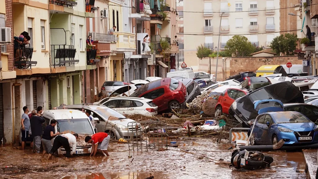
In October 2024, flash floods swept through the Valencia region of Spain in a matter of hours. Roads that had carried commuters that same morning became rivers by afternoon. More than 200 people died – many of them trapped in cars. Spain’s Council of Ministers later identified the failure to issue timely warnings as a key factor in the death toll. 

Extreme weather has always posed a risk to roads. What’s changing is how often it happens – and how severe it gets. Floods that used to come once every fifty years are now arriving every five. Heatwaves are buckling roads in countries that have never needed heat protocols before. Wildfire smoke is closing motorways where no one had a plan for it. 

Traffic infrastructure across Europe was built for a climate that no longer fully exists. The systems managing that infrastructure were not designed for what’s coming either. That’s the challenge – and it’s not a future problem. It’s happening now. 

The Numbers Are Already Sobering

The EU Agency for Railways tracked nearly 13,500 extreme weather events affecting rail networks across Europe between 2005 and 2024 – with a clear rise over the last decade. The total weather-related delays in just the 2015 – 2024 period are equivalent to losing between one and three full years of EU rail service. The cost in infrastructure damage is significant: Belgium’s 2021 floods caused around €65 million in rail damage, Germany’s €1.4 billion, and Spain’s 2024 floods led to €212 million in emergency repair works. 

For roads, the outlook is equally serious. A 2025 European Geosciences Union study projects that under a medium-high emissions scenario, roads and railways could face heatwave exposure up to 70 times higher by mid-century than historical levels, and up to 13 times more river flood exposure by end of century. 

The European Commission’s 2024 study on the trans-European transport network (TEN-T) put it plainly: climate adaptation is no longer optional. In 2024 alone, multiple extreme weather events left transport systems across Europe temporarily unusable – disrupting supply chains and stranding people. The EU’s first-ever European Climate Risk Assessment, also published in 2024, identified 36 major climate risks, of which 34 could reach critical or catastrophic levels under high warming scenarios. Infrastructure sits squarely in that list. 

What Extreme Weather Actually Does to a Road Network

Each type of extreme weather creates its own set of problems for traffic managers. 
1366x768 cmsv2 0e385ad9 bc36 5f2b bc23 78f0c341f530 9656058


Attēla kredīts: Copyright 2024. Associated Press. All rights reserved. Valencia.


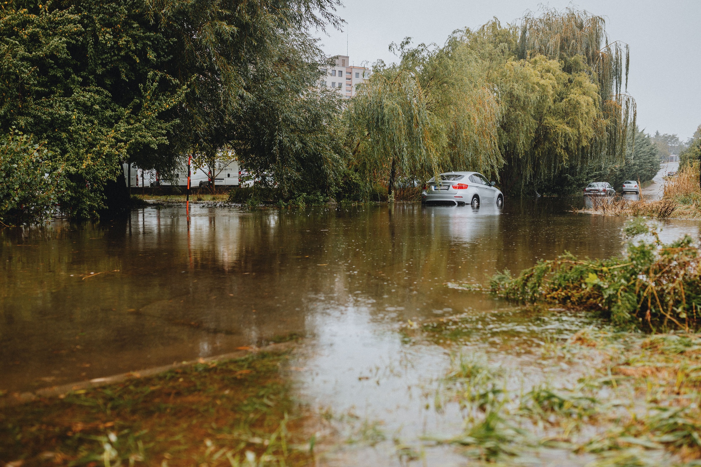
Flooding is the most immediate danger. Roads become impassable within minutes. Underpasses fill before drivers realise the risk. In Valencia, as in Germany’s 2021 Ahr valley and central Europe’s September 2024 floods, the physical damage was severe – but what made it deadly was the absence of timely warnings. Drivers had no information. Emergency services arrived too late. The infrastructure failed, but so did the communication. 
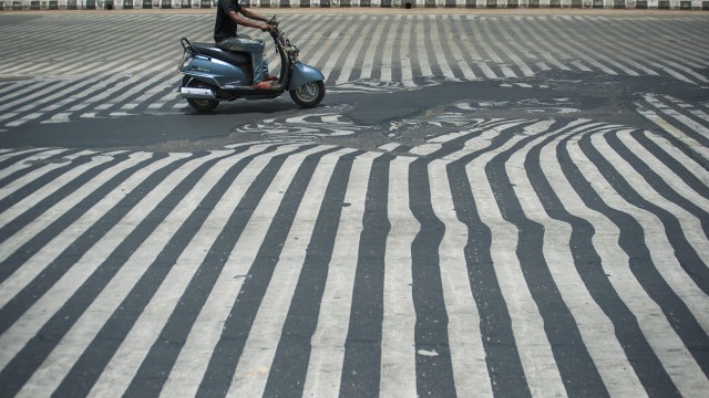
 

Image Credit: The Guardian, ITN 


Heatwaves do their damage more gradually but across wider areas. Asphalt can reach surface temperatures above 60°C even when air temperature is lower – softening and deforming under traffic. Rail tracks buckle. Speed restrictions have to be imposed not because of accidents or congestion, but because the road itself is no longer safe at normal speeds. Monitoring this in real time across a national network is a significant operational challenge. 


pexels ndumiso mvelase 1087086 29538111 1

Attēla avots: Pexels.com 

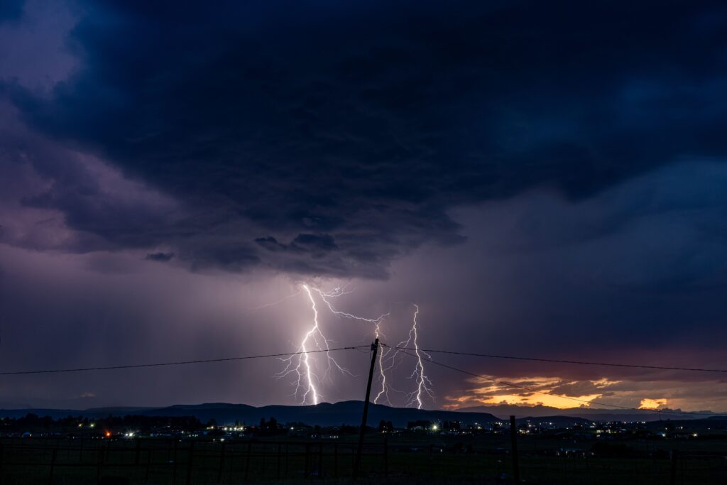
Storms create sudden, localised hazards: fallen trees, debris, near-zero visibility. The response window is often just a few minutes – far too short for maintenance crews to reach the scene before the next driver does. 
 

pexels kelly 33622177

Attēla avots: Pexels.com 

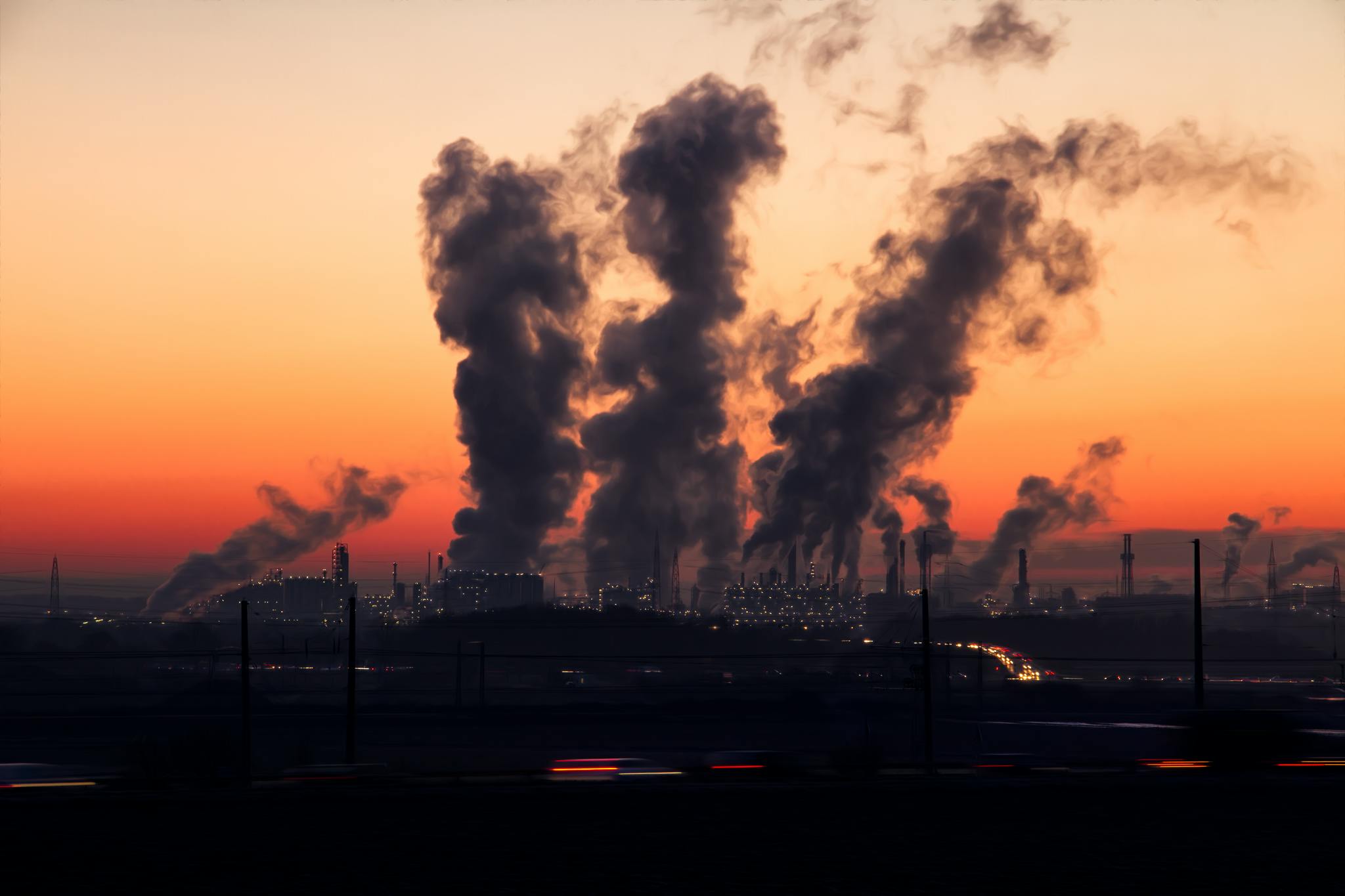
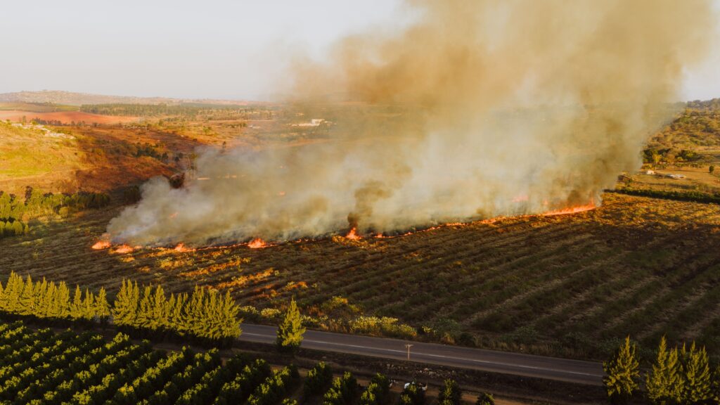
Wildfires are a hazard many Northern European transport authorities have never had to plan for – until recently. In 2024, wildfires burned across 21 of 27 EU countries, affecting roads in Portugal, Bulgaria, and Greece. Smoke can drop motorway visibility to near zero. Mass evacuation has to be coordinated on roads that may themselves be threatened. 

What these situations share is this: the difference between disruption and disaster often comes down to information – how fast it reaches drivers, and how fast traffic management systems can act on it. 

Three Ways Transport Systems Are Adapting

Physical hardening – raising bridge clearances, using heat-resistant asphalt, improving drainage – is necessary but slow and expensive. It also has to contend with genuine uncertainty: how do you design for climate conditions that are themselves still changing? 

Real-time monitoring handles what physical design cannot: the moment when conditions go beyond what was planned for. Weather stations, traffic cameras, structural sensors – these generate the data that allows managers to respond. The challenge is pulling all that data together into a clear, actionable picture, especially when the sensors themselves may be under stress from the very conditions they’re monitoring. 

Dynamic communication is where monitoring connects to drivers. A sensor detects flooding. The management system processes it. A driver gets a warning in time to take another route. That chain only works if every link holds – and the weakest link is usually communication. Variable message signs remain one of the most reliable ways to reach drivers in real time, particularly in areas with poor mobile signal or during emergencies when networks are overloaded. 

Signs That Work When the Power Goes Out

Extending warning coverage to rural roads, mountain passes, and remote corridors – exactly the places most at risk from flooding, wildfires, and storms – creates an immediate practical problem: there’s no power supply. Cabling every remote location is expensive. Battery systems need maintenance. And when a storm knocks the power out, a conventional LED sign goes dark. 

That’s precisely when drivers need it most. 

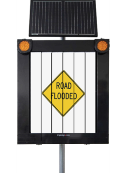
Piemērots satiksmei‘s partner Triplesign System AB, a Swedish manufacturer of variable message signs, has taken a different approach. Instead of LED panels, Triplesign‘s signs use rotating reflective prisms – the same reflective foil technology used in standard static road signs. Changing the message requires only a brief pulse of electricity. Holding it requires none at all. The result is a sign that consumes as little as 0,2 watts per hour – compared to over 1000 watts for an equivalent LED panel. 
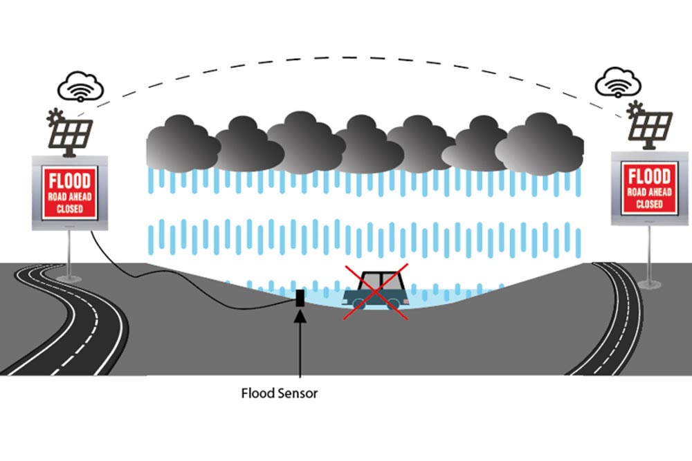
 

flood warning

flood

Attēla kredīts: Triplesign.com 

This makes solar power practical even in Scandinavia in winter, opening up locations that were never viable for permanent signage before. The signs are certified to EN-12966, the European standard for variable traffic signs, and have been used in tunnels, on highways, at toll stations, and on bridges across Europe. 

The critical point for extreme weather: when the power fails entirely, the message stays visible. A Triplesign sign cannot go blank. 

Together, Triplesign and Piemērots satiksmei offer a combined solution – Triplesign‘s sustainable sign hardware integrated with Piemērots satiksmei‘s management platform. This means remote management, automated message scheduling, real-time status monitoring, and data-driven insights, whilst keeping the hardware’s core advantage: it works where conventional signage can’t. 
What Connects It All: Fits Traffic

The real challenge in climate-resilient traffic management isn’t a lack of data. Modern road networks produce enormous amounts of it. The challenge is bringing it together – weather stations, cameras, traffic counters, variable message signs, traffic lights – into a single operational view where managers can see what’s happening and act on it before conditions get worse. 

That’s what Fits Hub does. It’s a unified back-office platform for roadside ITS equipment, connecting sensors of different types and manufacturers into one system. For managing extreme weather, several features are particularly relevant. 

One view of the whole network. When a flood event hits, a traffic manager needs to see road conditions, camera feeds, VMS status, and traffic flow across all affected locations – without switching between four different systems. Fits Hub’s map-based interface and real-time alarm notifications make that possible. 

Automatic fault detection. During extreme weather, equipment is under maximum stress. A weather station that stops reporting, a sign that fails to update, a camera that drops its connection – any of these can leave a section of road effectively invisible to the control room. Fits Hub detects faults automatically and flags them for faster repair. In Latvia, where Fits Hub monitors over 200 roadside sensors nationally, faster fault response translated directly into improved road safety. 

Automated sign management. Fits Hub can trigger pre-set message sequences automatically based on sensor data. A weather station that detects ice can immediately activate warning signs upstream – before a human operator has had a chance to review the data. When events unfold faster than people can respond manually, this automation matters. 

Computer vision from existing cameras. Fits Vision adds AI-driven analysis to camera networks already in place. It can detect stopped vehicles, queuing traffic, or wrong-way driving automatically – without an operator watching every feed. When a road floods and traffic stops suddenly, the system picks up the pattern and sends alerts. It also monitors road surface condition, flagging damage that heat or floods have caused before it becomes dangerous. 

Cross-border data exchange. Fits Hub supports the Datex II standard – the European protocol for sharing traffic data between management centres. Extreme weather doesn’t stop at national borders. The SMART E67 project, where Fits Hub connected ITS infrastructure across Latvia and Estonia, put this into practice: when conditions change on one side of a border, management centres on both sides see it in real time. 


What the Numbers Show 

Latvia’s national ITS deployment gives a concrete picture of what integrated management delivers. Before Fits Hub, data from roadside equipment was collected manually from separate systems – slow, fragmented, and prone to gaps. After deployment, road cameras, traffic lights, weather stations, variable message signs, and traffic counters all fed into one system, monitored around the clock. 

For a country where winter storms, ice, and spring flooding are routine, the operational impact was real: faster fault response, fewer data gaps, and lower overall operating costs. The unified system meant that when something went wrong – a sensor failing, a sign going offline – it was caught and fixed faster. 

The Via Baltica E67 corridor project took the same approach across two countries. The results: average driving times on the corridor fell by just over 2 minutes per vehicle, adding up to 192,000 hours saved per year. The project’s benefit-cost ratio of 4.4 – measured against the ROSEBUD WPS scale – shows that the investment in integrated ITS management pays off in normal operations, not just during emergencies. 


Tolerance vs Resilience 

Roads have always been designed to handle weather – standard drainage, normal temperature ranges, expected wind loads. The underlying assumption is that conditions stay within predictable bounds. 

That assumption is no longer reliable. Resilience means accepting that conditions will sometimes exceed what the infrastructure was built for – and asking: when that happens, how fast can the system detect it? How quickly does a warning reach drivers? How long before a failed sensor is caught and replaced? 

These aren’t engineering questions. They’re information questions. Europe’s roads can’t all be rebuilt for a different climate. But they can be equipped with better monitoring, smarter communication, and systems that respond faster than the weather changes. 

That’s what climate resilience in transport actually looks like in practice – and it’s already being built. 

Atsauces

European Union Agency for Railways. (2025, April). Rail Resilience to Climate Change: Impact of extreme weather events on the European railway system. https://www.era.europa.eu/content/rail-resilience-climate-change 

European Commission. (2024, December 19). Investments in climate adaptation should be an integral part of the trans-European transport network. Directorate-General for Mobility and Transport. https://transport.ec.europa.eu/news-events/news/investments-climate-adaptation-should-be-integral-part-trans-european-transport-network-study-shows-2024-12-19_en 

Ranasinghe, R., et al. (2025). Is Europe’s transport infrastructure ready to face climate change? EGUsphere [preprint]. https://egusphere.copernicus.org/preprints/2025/egusphere-2025-1697/ 

European Environment Agency. (2024). European Climate Risk Assessment (EUCRA). https://climate-adapt.eea.europa.eu/en/eu-adaptation-policy/sector-policies/transport 

Copernicus Climate Change Service. (2025). Resilience of the Built Environment to Climate Extremes. European State of the Climate 2024. https://climate.copernicus.eu/esotc/2024/resilience-climate-extremes 

Triplesign System AB. Prismatic Variable Message Signs for Traffic Environments. https://www.triplesign.com 

Traffic Technology Today. Triple Sign System AB – Supplier Spotlight. https://www.traffictechnologytoday.com/supplier-spotlight/triple-sign-system-ab 

Derams satiksmei. Traffic and Infrastructure Management; Computer Vision Solutions. https://fitstraffic.com/en/ 

Citi raksti

Mēs esam šeit, lai palīdzētu

Mēs esam šeit, lai palīdzētu jums ar jebkuriem jautājumiem — sākot no iesākšanas līdz jautājumiem, kas saistīti ar jūsu konkrēto situāciju.